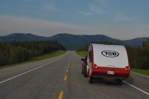
July 1st, 2015 – Dalton Highway, Alaska – 24 hours, 800 miles, mostly on gravel, under the midnight sun. Forest gave way to Tundra. In every direction wilderness. Never dark, the sun just circling the sky. A wide gravel road, extra ordinary road conditions, very light traffic. I saw moose, rabbits, several hawks, a fox and apparently helped a snowy owl find its dinner. The truck drivers were courteous, I was surprised to see several bicyclists, there were a few tourists.
 This day trip heading north out of Fairbanks began with the goal to cross the arctic circle, but the drive was so enjoyable I just kept going, and going. The arctic circle is about 200 miles north by road. So a round trip is a respectable 400 mile day of driving. The first 80 miles is the Richardson Highway, a paved two lane country road, rough, twisty, up and down it is much more work than a wide gravel road with smooth transitions and even grades. Granted if the weather had been wet the gravel would have been quite slippery, and if really dry, quite dusty. The weather was cooperating. It had rained recently enough to keep the dust down, but the road was dry enough that there wasn’t any mud kicked up. In fact this was so unusual that the folks back in Fairbanks thought my trip had been a bust when I came back with a not very dirty car.
 With so many fires burning around the state Fairbanks had been pretty smokey. Sometimes the wind was just right and the blue sky showed through, but mostly it was either a little or a lot smokey. Until I passed over the Yukon and a little bit further I was still in smoke. This made the views somewhat lack luster. Honestly this had me thinking I might choose to turn around at or before the Arctic Circle sign. But before I reached my original goal the smoke mostly cleared, and the sky was blue again and my spirits were high.
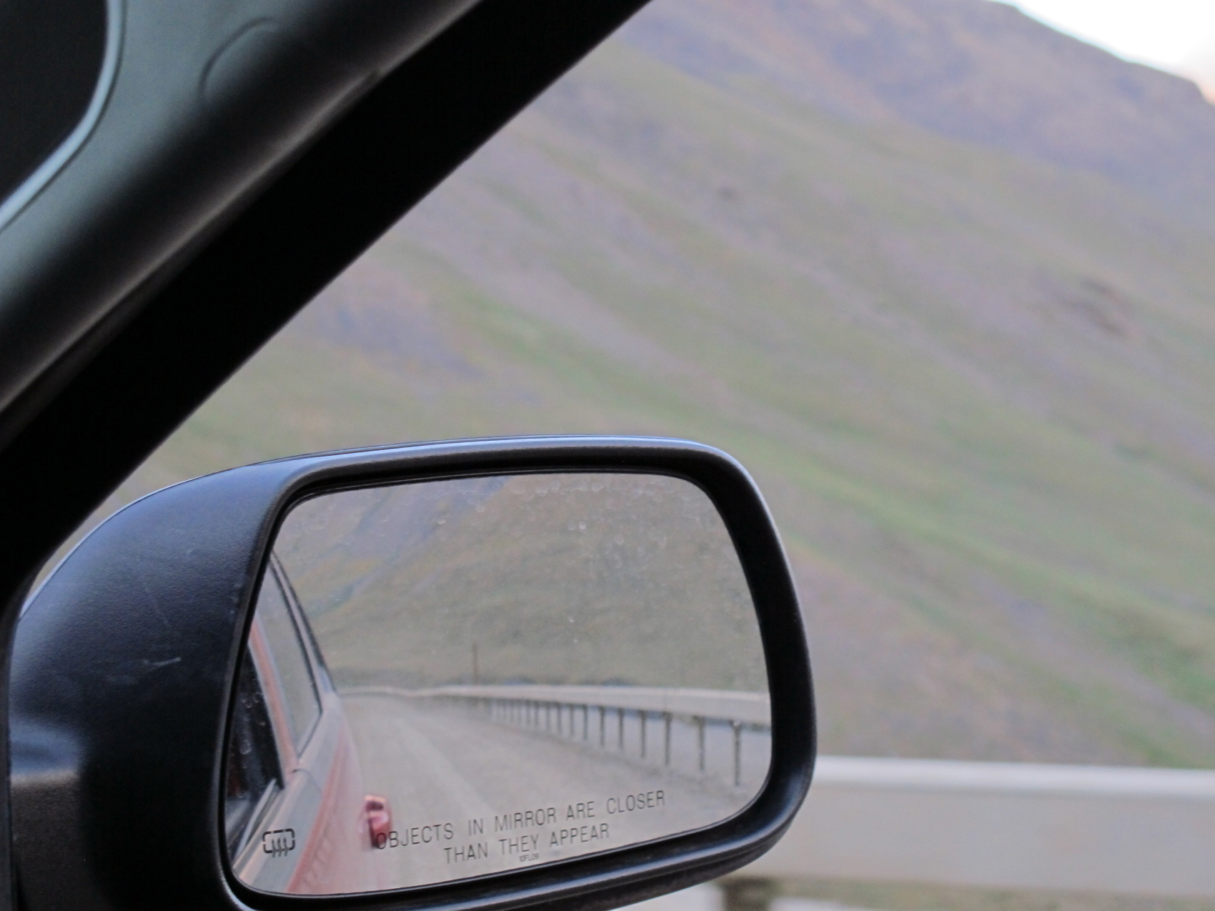
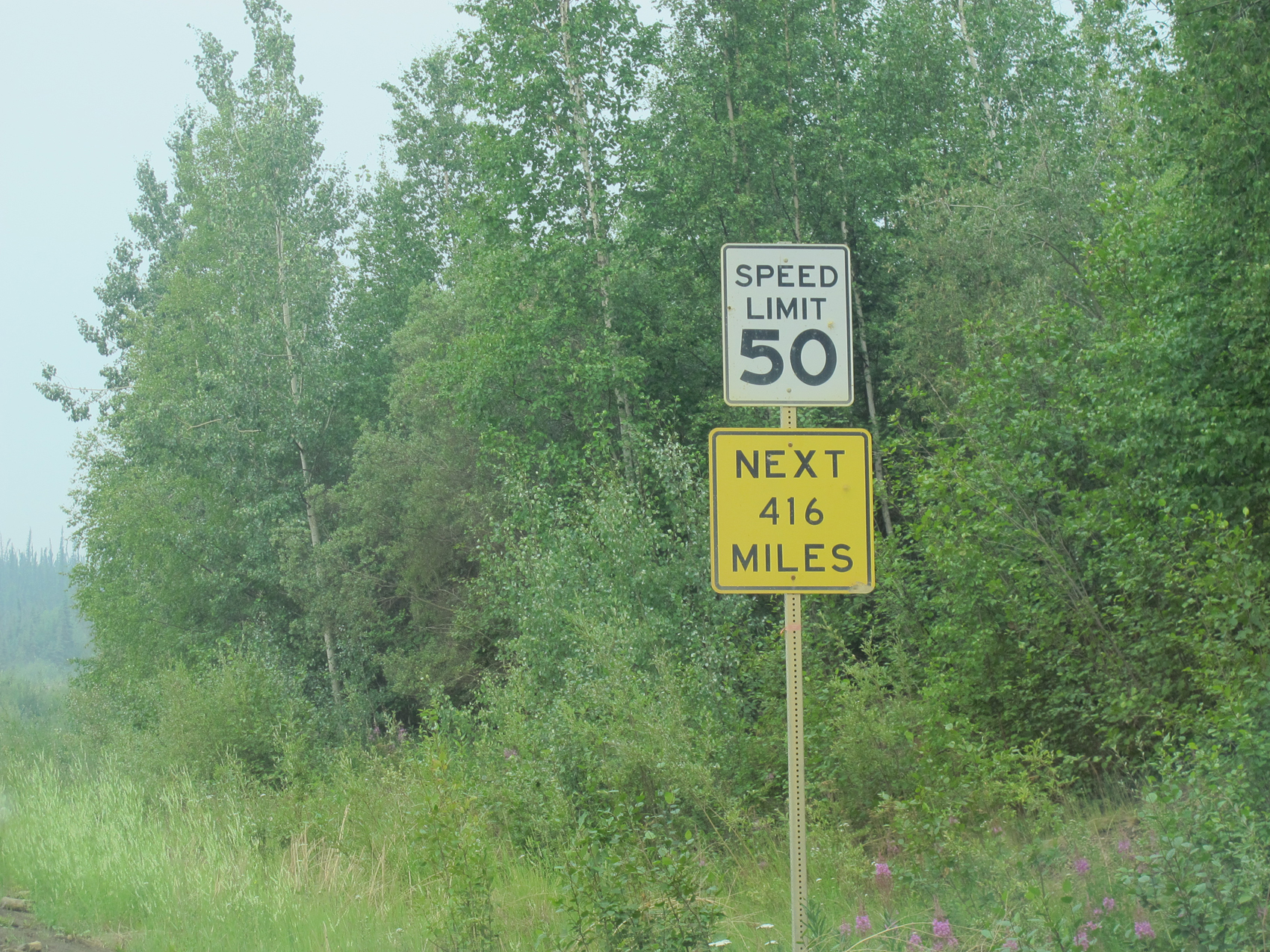 About 80 miles from Fairbanks the Dalton begins, and pavement ends for a while. From time to time there are stretches of pavement, but mostly it is a gravel road wide enough for two semi’s to meet easily. Rules of the road are simple, let the trucks do what the trucks want to do, and slow down when you pass to help protect your windshield. Don’t blink as you pass the one speed limit sign that tells you 50 mph for the next 416 miles. Actually they have posted a few other signs, but it certainly gives you a taste of the type of place you are headed. I found the truck drivers to be pretty easy going. I watched my rearview for folks who were coming up behind and pulled over early and let them by. For the most part they slowed a little when oncoming and pulled over to the far side. I slowed and could definitely see how you would otherwise drive into gravel that had been flung up, but not actually at the car.
I passed through some pretty heavy smoke and active fire camps alongside the road. At one point I passed by a back fire that had been lit to protect the road from intense heat of a full on fire. Since fire is part of the forest ecosystem, they let fires burn unless they threaten part of the human built environment, and then they focus on protection of the asset (building, road, etc.) rather than stopping the fire. A thankful wave and a smile to the fire fighters is returned in kind.
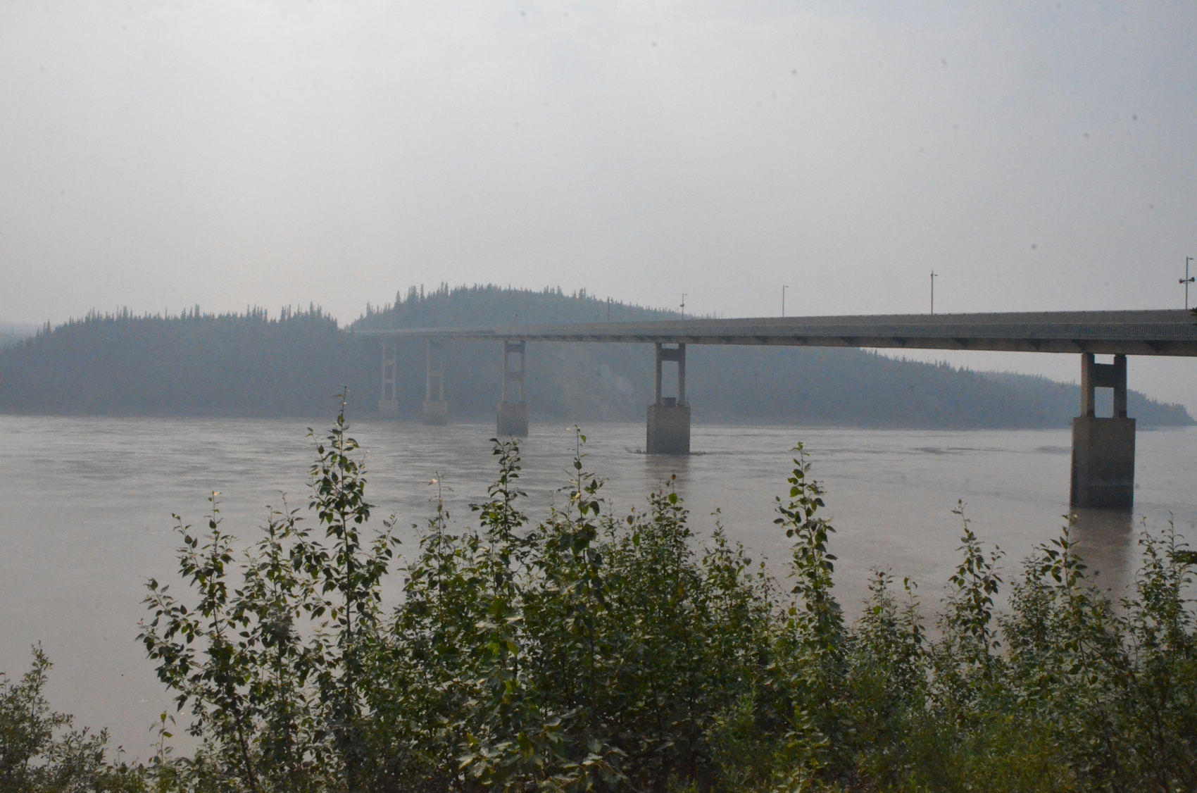 Arriving at the Yukon river bridge I will be crossing the fifth of five bridges over that grand wild river. I’ve certainly seen much bigger bridges, but considering the environment where this bridge has to stand it is no small feat of engineering. Not only do the trucks hauling supplies to the oil fields at Prudhoe Bay cross this bridge, and since the mid 90’s tourist traffic, but the pipeline itself runs under the bridge as well. Extremes of temperature push and pull on the structure as it expands and contracts. Ice crashes into the bridge piers every spring as the thaw comes.
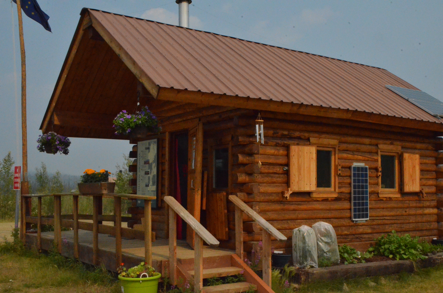 On the north side of the river there is a small settlement. Yukon River camp on the left of the highway, and the Yukon River visitor’s center on the right. Turning right you will drive under the pipeline, your one opportunity to do so. I stopped and talked with the couple who manning the visitor’s center, and walked to the river to get a better photo of the bridge. I enjoyed walking through the variety of plants and flowers here, and took in a bunch of the signs outside the center as well. Across the street it was time to fill up with gas, but the delivery truck had just arrived, they had just filling the above ground tank. The attendant suggested a short wait after the fill to let the sediment settle. So I went inside for lunch. A nice burger and fries and yes indeed, soda water.
Fuel. There are three sources of fuel along the Dalton, Yukon River Camp, Coldfoot and Deadhorse. The first Yukon river camp is about 135 miles out of Fairbanks, the second Coldfoot is another 120 miles along, and the last is at the end of the road, 240 miles north of Coldfoot. A wise person probably fills up at each of these spots. I had five extra gallons in cans on board, but my turn around point was pretty much half a tank north of Coldfoot. So i ended up buying fuel there twice in the same day.
At Yukon camp as I was eating my lunch I was entertained by folks were coming in to buy fuel. Many of the tourists didn’t speak much English, so the message of why they needed to wait was a little lost on them. Others appeared to be on a tight schedule and the inconvenience seemed like it was almost too much for them to bear. On top of this the place really wasn’t set up for rapid, efficient processing of fuel customers. The filling area was somewhat removed from and not in any way in sight of the cash register. The credit card machine’s connection was unreliable in good times, so out came the old knuckle buster imprint machine. So, not having any particular place to be I continued drinking my soda water, and let them all go ahead of me.
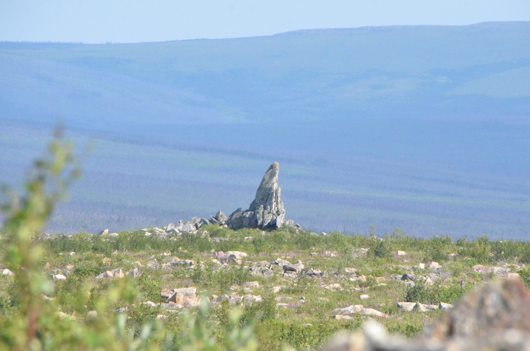 Back on the road I was soon out of the smoke. Another 40 miles along I came to a well developed day use area, Finger Mountain. In the middle of a wide valley, the tundra stretches for miles in all directions. The rocky outcropping rises up and provides a nice view point. Finger Rock is a short hike away, but can be seen clearly from a distance pointing towards Fairbanks almost two hundred miles away. A nice path winds through the unique terrain and interpretative signs are found at regular intervals along the way.
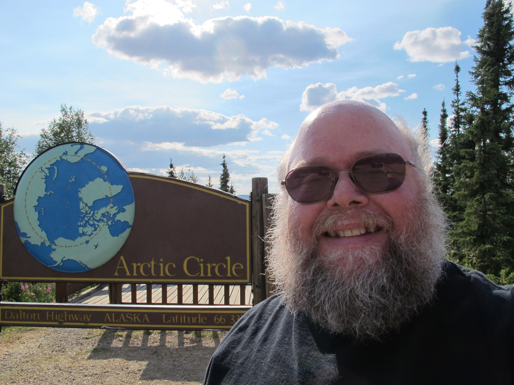 Another 17 miles or so and we arrive at the Arctic Circle Sign. The area is set up for buses and picnickers, and there are several pit toilets. But there are also plenty of insects, not too bad but… keeping moving a little was a good plan. The area is removed from the road a bit so that passing trucks aren’t much of a bother. I passed here headed north in the evening on July 1st and would be back here in the late morning the next day. So the sign was back lit on my first visit with the sun in the west and front lit the next morning with the sun in the east.
 Sixty miles up the road, now just over 250 miles from Fairbanks we arrive at Coldfoot. I highly suggest a stop at the very nice Arctic Interagency Visitor Center. Rangers were quite helpful. I was trying to decide how much further to roam north. The ranger told me that I should at least drive the next 20 miles or so, since they had just put down smooth blacktop. After that, he mentioned heading far enough over onto the North Slope of the Brooks range to get a good taste of the Tundra. But from there it is pretty similar all the way to Deadhorse.
Of course I already knew that getting to Deadhorse wasn’t the same as getting to see the Arctic Ocean. Deadhorse is a small settlement at the edge of the Prudhoe Bay oil fields. From there it is still 8 miles to the Ocean, accessible only by tour. Since the tour is through the oil fields, the security is pretty tight. To allow time for background checks they want at least 24 hours advance booking and I hadn’t planned that far ahead.
So I fueled up here at $4.99 per gallon, figuring it was a lot cheaper than airfare. Besides that, when you are this far away from civilization why bother complaining? Actually far from it, I was impressed that they had about the most modern pump I had seen in Alaska. Also, I have a scouting friend who works for Crowley, and I noted that much of the equipment in the oil fields in general was labeled with the Crowley name. So I had to take a selfie with the Crowley propane tank in the background.
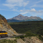
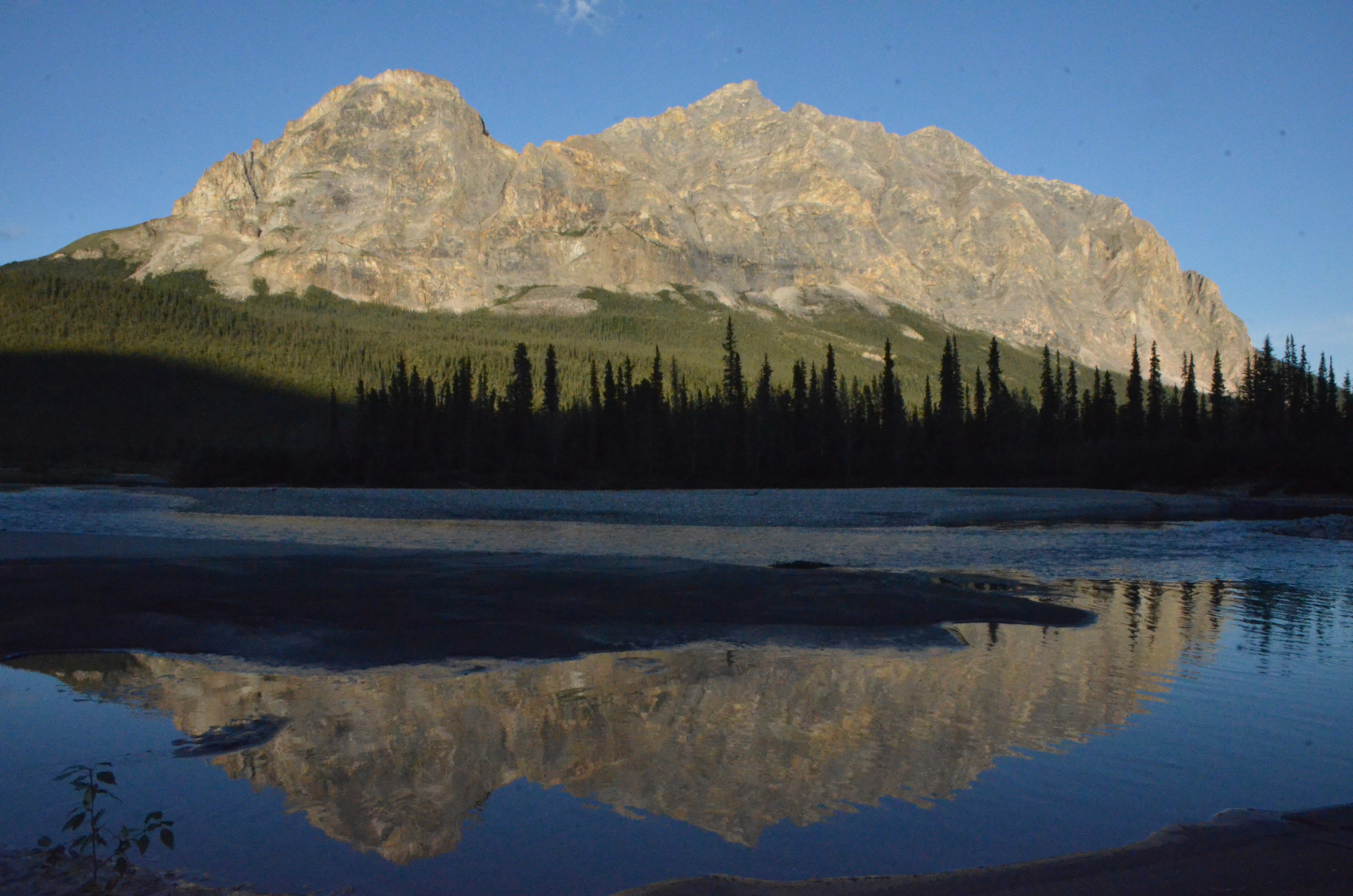
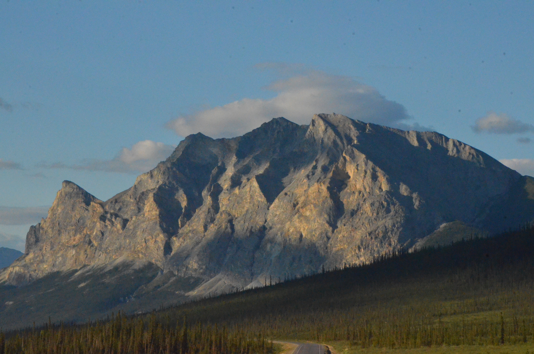 North we go then, beautiful blue sky, dark fresh asphalt, crisp lines and wide shoulders, but in the middle of absolutely nowhere. Craggy monoliths of mountains on each side caught the low orange sun and glowed golden. The shallow river meandering in its braided course keeps a wide swath bare of vegetation. The road then heads up a steep grade to Chandalar Shelf. Near here is a sign marking the northernmost spruce tree along the Alaska Pipeline, however according to the Milepost, vandals cut it down. The dead tree was recovered and put in storage at the Coldfoot Visitor’s center. There are at least three other spruce trees growing further north of this point now, but such a shame.
 Now we come to Atigun Pass, a name you might know if you watch extreme trucking shows. In the summer it is pretty tame, but in the winter it is avalanche alley. Signs warn truckers to call the avalanche control folks before proceeding, and not to stop anywhere along the way. The ground is gravelly and bare in most places. The mountain walls rise steeply and the rock is crumbly and loose. The clouds were rolling over the mountains from the west and north and as they fell off the ridges the white puffs turned to thin threads and disappeared in long strands. Lit by the low golden sun they took on a subtle glow like a sunset with redder colors at times. Not the kind of place you want to pull over and take photos, but I got a few on the run. There’s a wide spot at the top, so this is where I pulled over and watched the cloud show a bit. The wind made it pretty cold standing around outside.
 So Atigun Pass traverses the Brooks range, and now we’re heading down onto the north slope and into the land of wide open tundra. All the water here flows north to the Arctic ocean still a couple of hundred miles away. Frozen ground doesn’t let water soak in, so the smallest bit of rain or snow melt collects in ponds and standing water everywhere. Consequently there are a lot more bugs here than elsewhere.
The bugs seem to have learned that cars contain meat, so before you could even get out of the car they were swarming around the doors and windows. To get any pictures here I would look for a long straight bit of road and prepare the camera. Now I reduced the speed quickly to about five miles per hour, but not stopped. While rolling slowly I hit the automatic down button on the window. I used the delay until the window was clear to frame the shot. When clear take the photo, and hit the auto-up button. As the window was going up I put the camera down, corrected the path of the car if required and put my foot down to get back up to 30 miles per hour. Even with all that, I would typically take on a couple of mosquitoes each time. I tried taking photos through the glass, but you can see the bugs hovering in the shot just outside the window. So you really needed to be moving.
I drove through the Tundra with its vast open landscape. Your eye can’t even take it in, much less a camera. Then to think that this is all a vast wilderness. Here in the open tundra I had a great encounter with a snowy owl. It had apparently been waiting in the ground cover near the right side of the road, and as I approached it popped up and flew about ten feet above the hood of the car matching my speed of 30 miles per hour or so. I strained forward to look up through the windshield to see it, and before I could even think about grabbing a camera it banked abruptly and pounced on something to the right of the road. I hit the brakes and tried to look back to see it, and even turned around and drove back past, but for a huge white bird in a green and brown environment with no bushes or trees it had absolutely disappeared. I seems like it has learned to use vehicles as a way to scare up dinner.
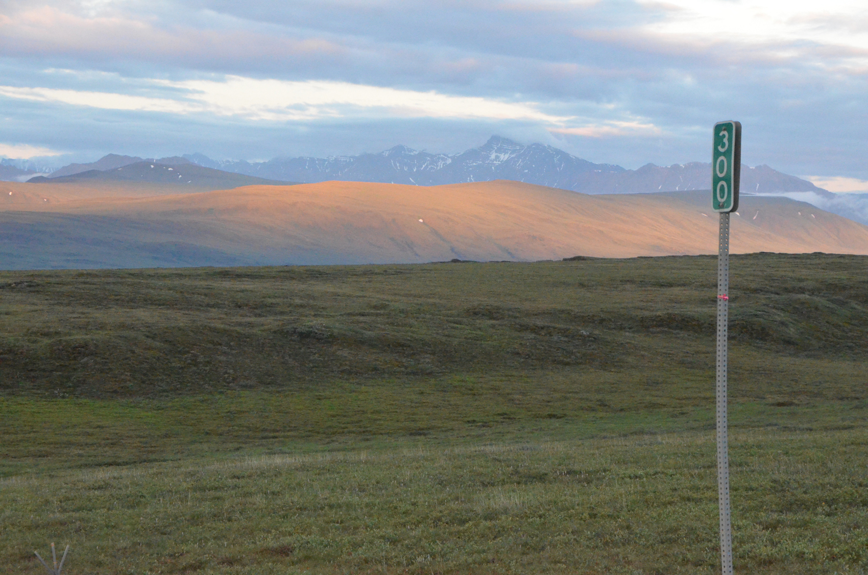 My turn around point was a little past milepost 300. Distances can be deceiving, but I figured I could see another twenty or thirty miles up the road. It really didn’t look like the scenery was going to be changing any time soon, and the map and ranger had concurred. So it seemed like as good a turn around point as any. While that is still over a hundred miles from Deadhorse, every mile north is also a mile south, and I had been on the road for about 14 hours on my “day” trip so far.
The return trip was quicker, because I knew where I wanted to stop, and didn’t spend nearly as much time in these places. I also had the feel for the road and averaged a little higher speed. I really enjoyed the road, letting the car get a little squirrelly on the gravel. But it was on the way back that I saw the most animals. Probably because it was morning now. I saw several snowshoe rabbits along the road in the tundra.
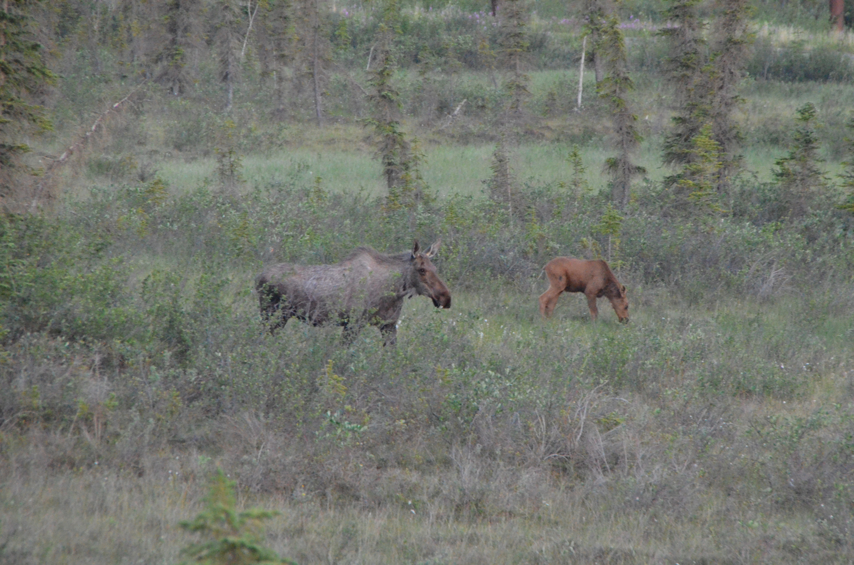 I spotted a mama moose and her calf grazing from a little bit of a distance out, and stopped a long way back and got out. I stayed on the road where I had a little height advantage and used the long lens to click off a bunch of shots. This area was still pretty far north, so the bushes were scattered and the few trees very small. The pair were moving around quite a bit, and roaming mostly my way. The calf would wander one way then another and the mother would trot along to catch up. Then the calf would fall behind. When they got closer a truck went by and spooked them and they trotted away from the road, out of range.
Further along I spotted a shape in the road well ahead. As I slowed I made out the shape of a fox, that big fluffy tail and sharp little nose. It lingered in the road, and looked my way, then crossed and disappeared. My stop gave me a little longer look, but I wasn’t close enough for a photo.
I spotted one more mama moose along the route, much further south there was a lot of low bushes for her to munch on, so she was moving around a lot less. I took her pic through the open passenger window. Happily much fewer insects south of Atigun Pass.
I should also mention that I saw several bicyclists along the road. Three if memory serves, each one apparently solo and probably more than a day’s ride apart.
Nearer the end of the day I had a flat in a rear tire. I heard the rock rattle around in the wheel well and the tire pressure monitor light came on about 30 seconds later. I quickly stopped a couple of times to look at the tire to be sure it was still partially inflated. In this way I limped about 20 miles into Yukon Camp and used their air to pump it up. But that was wishful thinking.
About forty miles further the tire was too low to continue on safely. So I found a nice concrete pad near a bridge and proceeded to change it out with the spare. Had I thought to bring my little compressor from its storage spot in the trailer I could have refilled it a couple of times and avoided this work, but that’s a live and learn sort of thing. The Goodyear folks back in Fairbanks were having a slow day, so they enjoyed getting something to do. They fixed the tire and didn’t seem all that interested in charging for the repair (doing the paperwork), so I gave them a little tip instead.
Well, 24 hours and about 800 miles later I was back at the trailer. No rain, very little dust. Off to bed. The next morning I met up with Duncan and he asked if I had decided not to do the Dalton per my stated plan. He was surprised when I recounted the story. The assumption when driving that road is that your vehicle would be uniformly gray/brown of the spattered mud with two clear spots where your windshield wipers had been busy. Not so for my epic journey. Certainly one of my favorite stories from the whole six month trip.